-
- Herðubreiðarlindir
-
- Bræðrafell
Iceland: Hiking the Askja Trail
While many people are familiar or have heard about the Landmannalaugar hike, the Askja trail is a bit less popular. Unlike Landmannalaugar, there isn’t a lot of instant gratification for “day travelers” who just want to get off the bus and take awesome pictures to impress their friends and relatives. If you think of Landmannalaugar as the heavenly volcanic Iceland, Askja trail in mid-August is what hell would looks like when you are unexpectedly dropped onto the surface of Mars.
How to get there?
To get to the Askja trail, the first stop will be Akureyri. There are two ways to get to Akureryi from Reykjavík: either by bus or plane. The bus leaves the Reykjavík BSI bus terminal at 0800 and arrives at Akureryi in the evening. Local flights from Reykjavík to Akureyri only takes 45 minutes, and there is pretty much a flight every other hour. Both the BSI bus terminal and the local airport are within walking distance from the downtown area. In fact, they are located side by side.
The next stop after Akureryi is Reykjahlíð at Myvatn lake. There is a SBA bus leaving Akureyri for Egilsstaridr, which stops at Reykjahlíð, at 0800 everyday. (see http://www.sba.is/en/scheduled-bus-service/summer-schedule/akureyri-egilsstadir ) Simply show up in the morning at the bus terminal and get on the bus. The journey takes about 2 hours.
There are two ways to reach the Askja trail:
Option 1:
The only transportation from Reykjahlíð to Herðubreiðalindir is a 100-dollar tour operated by a local company. ( see http://www.askjatours.is ) The bus ticket can be purchased the day before at the official Reykjahlíð tourist center located right next to the SBA bus stop (or on the spot directly from the tour guide in the morning). In August, there is no need to book ahead but you may want to book ahead in June and July. Because the bus leaves at 0800 in the morning, one is pretty much forced to stay in Reykjahlíð for at least one night. There are many campgrounds and motels in the area, including a hostel within walking distance from the bus terminal. There is a supermarket at the bus terminal, so it is not absolutely necessary to purchase food at Reykjahlíð.
Option 2:
Start the trip at Myvatn lake and follow the track on the eastern edge of Graenavatnsbrunito the east side of Blafjall. Come out from south of Blafjallshalar and cross the lava field to reach Botni. Follow the Askja trail in reverse order to option 1. This is a good way to start if you want to walk all the way back or continue to Kverkfjoll. Many guides suggest starting or ending at Svartarvatn. However, there is no direct connection between highway F26 (the closest highway to Svartarvatn) and highway 1. So you must somehow hitch a ride to get there, or leave there.
Preparation
Askaja trail is well marked from Herðubreiðalindirto Botni hut. The Iceland park service does a pretty thorough job of maintaining yellow stakes at 100m intervals along most segments of the trail. In most parts, the markers are still visible even if it becomes very foggy. On the other hand, some of the stakes could be broken along the path, especially in segments under high wind. Under foggy conditions, sometimes even the most closely spaced stakes could not be seen, especially in Dyngjufjoll. While a sense of direction and sometimes tracking of soil disturbance could keep you on track, GPS/compass and careful study of the topographic features, in addition to good pacing, could get you out of a jam when it becomes very foggy. Sometimes the trail needs to circumvent local features which may not lead in the simplest direction.
From Botni hut to Myvatn lake, you could follow tracks that run through private land. I recommend a copy of 1:100 000 Myvatnsoraefi map, which is available in many bookstores at Reykjavík.
For campers, standard isopro canisters can be obtained in Akureryi at gas stations, as well as “North 66” on Glergata street. I won’t recommend counting on Akureryi if you need to get completely kitted out. The selection is limited and the price is high, in addition to the already high Icelandic price.
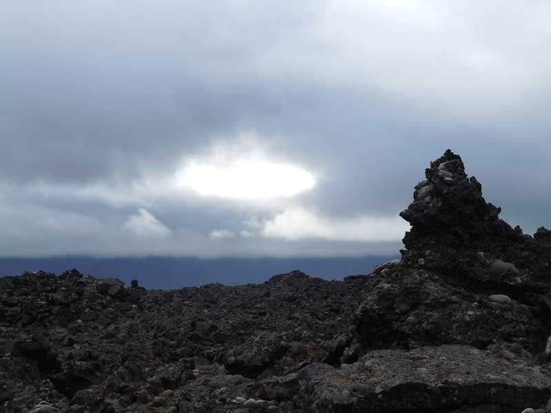
DAY 1: From Herðubreiðarlindir to the hut in Bræðrafell 4-5 hours
The bus tour lef Reykjahlíð bus station at 0800 in the morning. It headed east and turned onto a track that ran south along Jokulsa a Flollum, the largest river in Iceland. I had my first encounter with river-stuck vehicle when we were crossing a 15m wide section of the beaded river. The poor family had their min van stuck in an underwater trench. There are good reasons why the tourist center strongly suggests high clearance vehicles with 4WD capability. Unfortunately, there was not much we could help, and these people would be waiting in their water lodged van for hours.
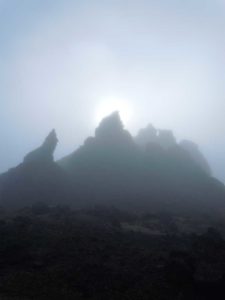
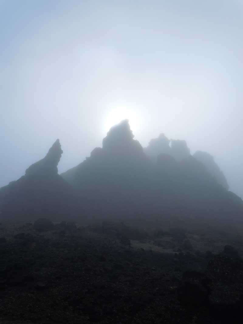
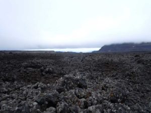
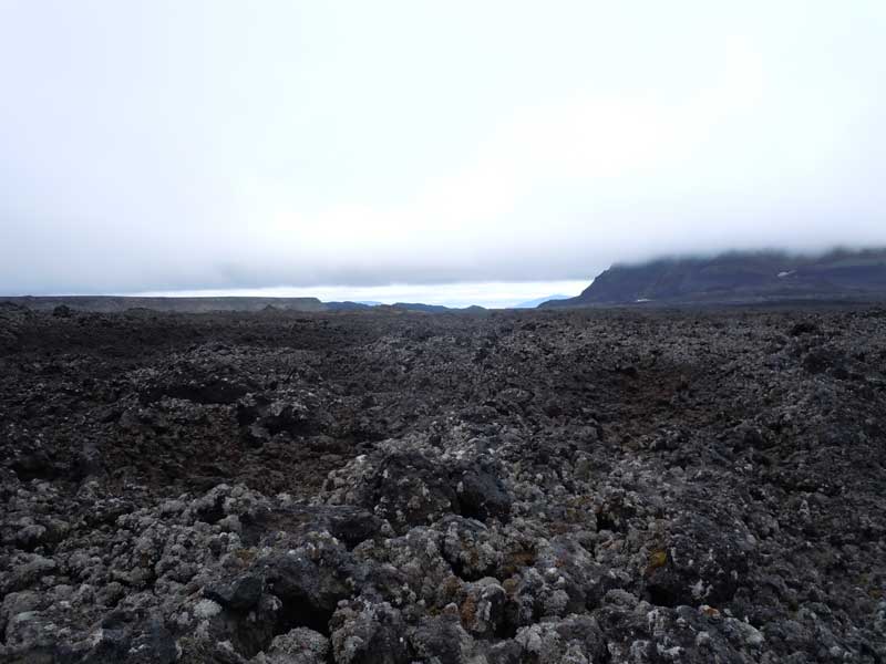
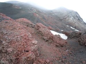
By the time the tour bus arrived at Herðubreiðarlindir, it was already 1030ish. The mid-August weather was probably not the brightest and warmest in this part of Iceland. As a matter of fact, the wind had picked up already and it had started drizzling. The post card picture of Herðubreiðarlindir behind a lively and cheerful green pasture had left without a trace already. Instead, I was presented a forbidden volcano surrounded by a sea of black frozen lava under a veil of fog. HELL.
I quickly reported to the park ranger and did my final equipment check. Desperately trying to leave behind the bus crowd, I ran deep into the lava land. Time seemed to be frozen here, along with all lives and movements.
The first leg of the hike took me around to the west side of Herðubreiðarlindir. After a smooth and dark basaltic highway at the foot of Herðubreiðarlindir, the ground transformed itself into a nightmare of loosely packed pumice embedded in a fine sand mixture. To make it worse, the trail began to go uphill. I should have stretched my left calf!
As the trail became more exposed to the north face of Herðubreiðarlindir, wind was shrieking like mad men in a nuthouse. The wind was bouncing off my gortex and poking for the smallest openings to gain entry into my body. Here I could barely hear anything other than my own breathing, as wind was overwhelming every bit of sound. Tumulus of cracked lava were looming along the trail under a veiling fog, as if they were waiting to ambush and devote any strangers. Yes, I might be exaggerating a bit but it was windy!
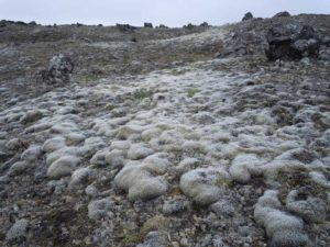
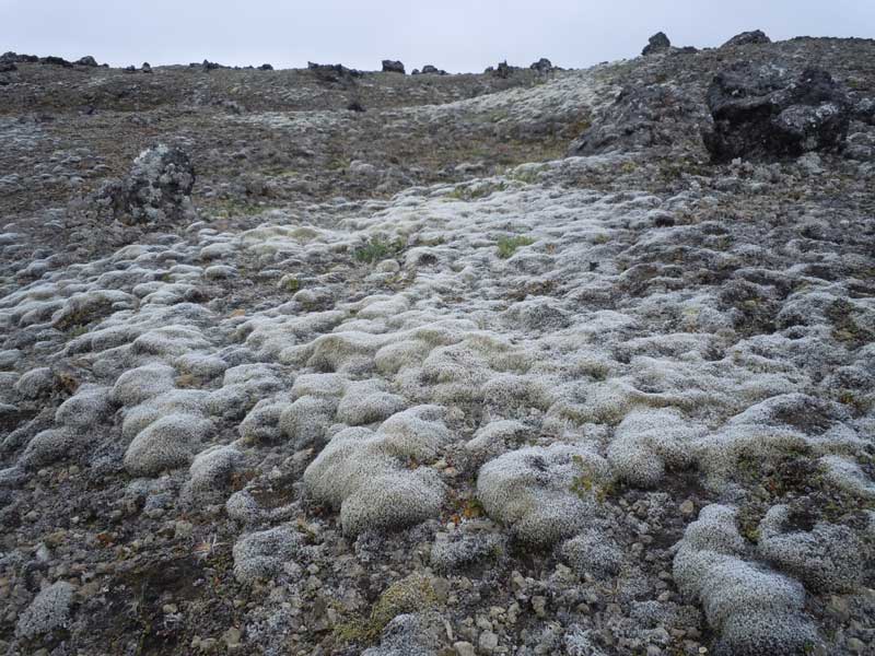
Once I had reached the west face of Herðubreiðarlindir, the sun came out but the wind still would not die down. The trail branched westwards away from the volcano, and led me across a sea of tumulus to Bræðrafell. By mid- August, the green moss that was flourishing earlier in summer had already turned grey and died. There were remnants of the expired lives scattered on the lifeless volcanic rocks. Lava domes were breaking out left and right, as if the land had imploded from within after giving birth to a million of Xenomorphs!
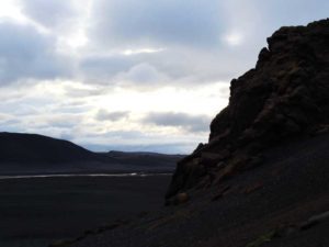
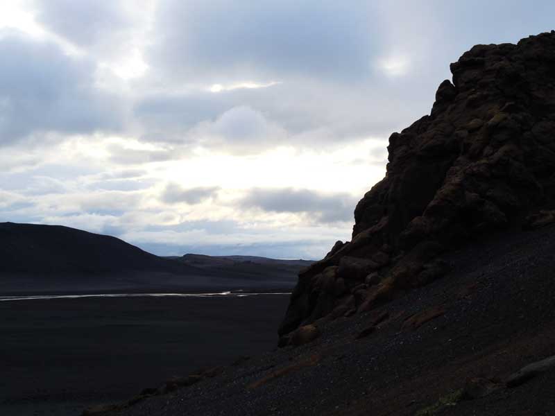
By the time I reached Bræðrafell, it was about 1600. Bræðrafell had a lone hut that stuck out on its own at the edge of the lava field. Imagine seeing an outhouse when you are visiting the surface of Mars.
Day 2: From Bræðrafell hut to Dreki hut 4-5 hours
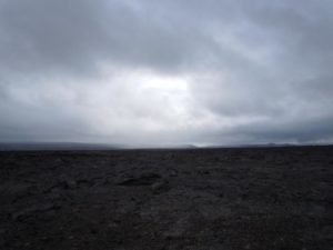
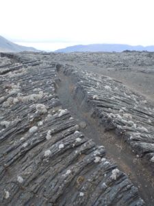
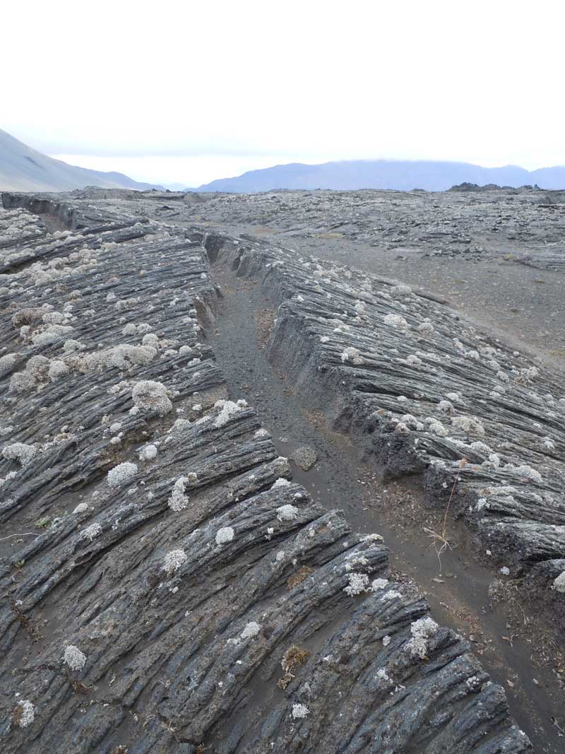
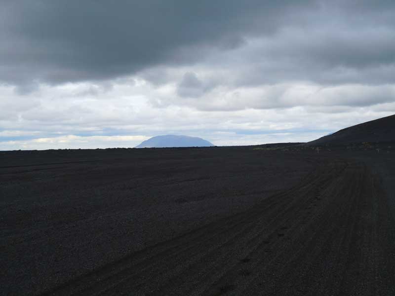
I got up quite early but the comfort of the hut really made departure difficult. The trail from the Bræðrafell hut to Dyngjufjallahals took me across a field that was made up of broken lava and up heaved boulders. Cooled lava blocks were hurled, cracked and scattered by the force of nature, and placed in grotesque positions and arrangements that only a mad man could imagine. Clumps of moss, which were grey and appearing lifeless by this time, were still stubbornly clinging to their hosts like parasites. What a great scene for breakfast of bean and sausages!
To be honest, the stretch between Dyngjufjallahals and Litlakista was quite boring. At one point, the trail turned into a jeep track and the best I could do was picking up the pace to hope for the end of this boredom. The landscape turned interesting once I left Litakista and began to cross Vikranhraun. On a side note, I suggest readers to google this old Japanese animation/magna, Nausicaä of the Valley of the Wind. Apparently the poisonous fungal forest in that story was inspired by the creator’s visit to this part of Iceland.
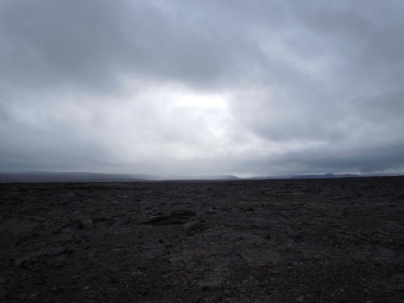
Once I crossed the moss infested area, I broke out my compass and looked up this giant A”a” lava field in front of me. As much as I would like to aim south-west to reach the Dreki hut, it was impossible to climb the giant A”a” . The trail had to snake along the edge of the lava field and I had to finish the last leg on a road. I dragged my body across the seemingly endless pumice desert as I looked up my GPS to make sure I would not walk an extra inch that I did not have to. On the ground, the trail seemed to be longer and it had turned more eastwards than it was shown on the map.
The sight of Askja was relieving, and seeing the Dreki hut was pure joy. By this time, I was pretty bored of seeing suburbans flying by without a single ride offer! At the end, the Dreki hut was well worth the walk. It was like a motel. It had its own kitchen, dining area and indoor bathrooms. They also staffed the most attractive female rangers at this location. I was thinking about sleeping outside in my bivy bag, but it did not take much to convince myself it would look pretty stupid to sleep next to someone’s vehicle.
-
- Vikranhraun
-
- Askja
-
- Askja
Day 3: From Dreki hut via Askja to the hut in Dyngjufell. 8-12 hours
I started off my hike at 0600 in the morning because it would be a long day. Getting up Askja under a thick fog was interesting as I could barely see what it was in front of me. Fortunately, the marking sticks were pretty closely spaced and I did not really have to navigate. As I was getting higher up, the weather took a worse turn as rain and wind start pounding without mercy. I jumped into my gortex suit behind a boulder quickly. The scene was eerie, there were grotesque volcano outcrops looming in the distance while wind was shrieking in the background. As soon as they revealed themselves, they quickly got lost in the fog again. Other times, I could only see the rough outline of an outcrop, thinking that they were actually very close to where I stood. All a sudden, the fog cleared up, and I realized they were actually giant features that were on the other side of the cliff. Perhaps these are the sources of ghosts and monsters in Icelandic folklores?
Once I cleared the ridge line and got close to the crater, the weather instantly turned for the better. I quickly shredded the gortex and jogged downhill to make gain on the clock. I got a quick glance of the crater lake Oskjuvatn but it was gone and covered by cloud as soon as I could get my camera out. The clouds came and went so quickly, that the views could be completely covered and reappeared again within fifteen steps. For people who drove up to Vikraborgir and hiked to the crater lake from the north, they were missing the approach to Viti that could only be experienced by descending from the east. I strongly recommend hiking the trail at Drekagil instead of driving around Askja to the parking lot at Vikraorgir.
By the time I reached Vikrbborgir, it was already noon. The fog was thick and visibility was no more than 100m . There was no marked trail across Goðagraun, from Vikaborgir to Jonsskrd pass. Normally that shouldn’t be a problem because on the map it was just a flat piece of lava field with a couple of contour lines. In real life, this flat piece of lava field on the map was a cemetery of sharp edged broken rocks shattered and piled on top of each other to as high as 6 feet. The starting point of the trail, which was just a sign “To Dyngjufell” that pointed in the general direction of the route, was rather glamorously set up at a random spot on the edge of the parking lot . In that direction, there was nothing else other than a wall of white mist. I took the bearing off the map and had to navigate through this lava field outcrop by outcrop every 100m. After two and a half hours and a few cuts on my shanks, I finally crossed the field and reached the north side of the crater. Then I figured out I had done it the hard way because I was only 2km away from Jonsskard pass. Instead of making the shortest 1km run from Vikraborgir to the northern edge of the crater, I followed the edge of the outcrop and veered off a bit westwards. In the process, I climbed through an extra kilometer of broken rocks. Anyways, lavafield crossing was pure hell. It was hell on the feet, hell on the boots ( my boots got cut up so bad it looked like it was ready to retire after 10 years of use) and hell on the body. I was bogged down for two hours there.
-
- Goðagraun
-
- Goðagraun
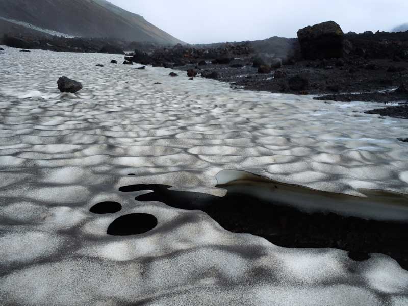
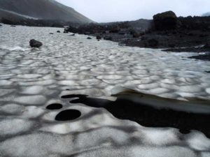
After getting the sharp rock treatment, at least I got some rewards in the form of good scenery. A large part of the crater on the north side remained covered under ice, even in summer. Ice sheets were spilling out of passes and carrying boulders into the crater with them. They were then carved out hollow underneath by water, until there was only a paper thin layer resting on top in defiant of gravity and structural strength. Below the surface, there were numerous tunnels that were barely high enough for a person to crawl under. Black fragments of volcanic rocks deposited by wind and were then left to highlight the waving surface of frozen water.
While it was nice to look at, climbing up the ice sheet in Jonsskard was a different matter. If I would have known of this beforehand, I would definitely bring crampons or spikes, but a pair of hiking poles would definitely make life easier. Getting up Jonsskard was a bit of work as I snaked up among the trenches on the west side of the pass. As the clock was ticking, I started picking up the pace but the fog was also getting thicker. I was walking down a mountain pass but I could barely see the rock bases on both sides, and had no idea how high the ridge line really was.
-
- Jonsskard

-
- Dyngjufjalladalur
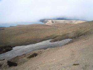
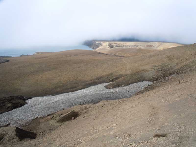
At one point, I could not see the marking sticks and had to track prints on the ground. There was a river running on top of the ridge, so the path was not necessarily straight as it had to cross over to the other side. As soon as I cleared the foggy top, I turned around and had a better appreciation of the height of the ridge. Unfortunately, the ground had also turned into a sea of nightmarish rolling pebbles embedded in sinking sand. As the needle in the suck meter was rapidly swinging to “high”, I completely broke through the fog and saw the blue sky ahead. Over the horizon and below the cliff was the glacier valley that led to the Dyngjufell hut.
The sky was turning dark. Officially the time of sunset was 10 pm in the evening, but really it started getting gloomy around 8. I almost broke into a shuffle in the last two kilometers as I was very eager to drop my ruck and get food into the stomach. As I was approaching the hut, I saw that it was built behind the river. WHY? Out of nowhere, a human figure popped up, trotted around the river bank a few times, disappeared and reappeared just outside of the hut. As I was scanning the river bend, the voice broke out in a German accent: “follow around, you can cross here!”
We quickly boiled up some water and cooked up some brew. Pete was a teacher from Germany ( no wonder he got so many vacation days to stroll the planet!). He got this down to earth global trotter appearance: wore out hiking boots, backpack from the 90’s and low end camping equipment. Behind his humble appearance, there was the mind of German planning and execution. As I was sucking down chicken pineapple rice off the bag, he pulled out his map and started explained his itinerary. He began his journey at Myvatn lake and followed the track on the eastern edge of Graenavatnsbrunito on the east side of Blafjall. He then came out from south of Blafjallshalar and crossed the lava field to reach Botni and finally Dyngjufell. His route was essentially the reverse of my own. This was a good way to go if you intend to continue to Kverkfjoll, like Pete was intending.
Day4: From Dyngjufell hut to the hut Botni. (Dyngjufjalladalur) 4-5 hours
I got up late. By the time I had breakfast and was ready to go, it was close to 1000. I had read some of the trip descriptions in other guided tour websites, and most of them had glorified trekking through the “black desert”. The reality was that I almost fell asleep walking through it ,as I was going at 120 paces per minute to try to get it over with as quickly as possible. As my position became more and more northwards, the scenery was gradually incorporating more “green” amongst the variety of volcanic rocks. Because of the plants, much of the sharp edges of the lavafield was blunted and became climbable. Finally, they became soft enough for me to walk over. Getting tired of zigzagging along the edge of the A”a” field, I took a direct bearing to the Botni hut, climbed over the edge of the lava field and did a short cut right over it.
-

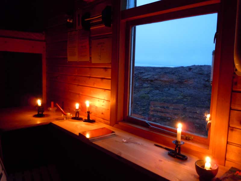
- Inside the Botni Hut
By the time I got to the Botni, it was only about 1400. The minute I set foot into the perimeter of Botni, a rain storm came and unload over my head. With about 35 km left to the southern edge of Myvatn lake, I debated whether I should continue and cover another 10 km before resting south of Sellandafjall. My plan was to intercept the bus leaving from Akureryi for Reykjavík at 1515 in the following day. Another option was to walk all the way back to Akureryi through the night and have a beer next to the bus terminal in the morning. As the rained went on, I decided to get lazy and hide in the hut for the rest of the day.
The rain stopped after an hour. As I was pumping and filtering water through the bird infested pond, I heard the distant rumbling of a vehicle. The idea of getting ride back to the town popped up in my mind. To my dismay, the vehicle was heading in the opposite direction. I flagged the vehicle down and had a short conversation with the driver, and watched his mini-van, the one that you would see in the crowded cities in Europe and Asia, slowly crawled its way out of my sight. I wondered how long it would take for the guy to have his van stuck over an outcrop across the trek.
For the rest of the day, I was plotting my final approach to the southern edge of Myvatn. I had decided to go northeast of Botni and followed the main track to Sellandagrof through Katlar. At the Y junction north of Sellandafjall, I would go northeast and then head north to Strengjabrekka. From that point on, I would cling to the western edge of Grænavatnsbruni until I hit the settlement of Grænavatnsgrundir, where I would follow the road to No. 1 ring road around Myvatn Lake. It should be about a 40km walk with little evaluation change. I was surprised how fast I fell asleep after plotting out the route.
Day5: From Botni. To Myvatn Lake 8.5 hours
It was drizzling at 0630 in the morning. The race was on! After carefully making sure I was on the right track under fog and rain, I broke into the northbound main track and started going at 120 steps per minute.
The early morning wetness was clearing up once I had left Botni and entered Katlar. The warmer weather at lower altitude had changed the lavafield into a fertile grassland. The distinct rocky landscape that I had grown accustomed to in the last four days was now covered by a thick green carpet. A herd of sheep were staring at me as I approached, and started scurrying away in a hurry when I beaome too close for their comfort. It was nice to see some green after seeing grey, brown and white for 4 days in a row.
I was counting my pace all the way as I wanted to make sure I would not miss any intersections. For most parts my pacing was banged on, but I believe the intercsection north of of Sellandafjall was slightly closer to Sellandafjall itself than it appeared on the map.
By the time I got to Grænavatnsgrundir, it was almost 1500. I started shuffling down the country road as I could see the edge of the highway. When I was 300m away from the highway, the bus flew by! I looked at the watch, it was 1315. I was PISSED. I got to the side of the highway, thinking that what an ass for the bus driver to take off early. As I was contemplating my next move, the “real” bus arrived. I jumped into the bus and tossed my ruck to the center of the aisle at the back. I knew I am going to have some fish and chips at Reykjahlíð.